
Community listing page, reviews here may not be monitored by the author.


Community voices
Reviews
No reviews yet. Be the first to review this project!
Get it on
Available Platforms
Compatibility
Supported Environments
Required on the server. Installing it on the client adds functionality.
About
Project Details
For authors
Embed Badge
If you're the author of this project, you can embed a live badge anywhere that supports HTML or Markdown. It updates automatically whenever ratings change.
Use HTML for any page that supports it, or Markdown for README files and Markdown-based descriptions.
Identifiers
Platform IDs
Resources
External Links
About
Description
Terrarium Expanded
Bring the Earth into Minecraft with real-world terrain, biome-driven landcover, and configurable world scale.
Terrarium Expanded includes integrations for:
- Biomes O' Plenty
- Regions Unexplored
- Nature's Spirit
- Datapacks that increase the world's minimum or maximum Y level
Requirements
- Minecraft
1.21.1- Java
21+- A live internet connection during world generation and exploration
Terrarium Expanded fetches three live remote data sources:
- Terrain tiles
- Surface-water tiles
- Ecoregion tiles
If those services are unavailable or blocked, world generation quality and completeness will degrade.
What The Mod Does
Terrarium Expanded generates an Earth-shaped overworld from real map data instead of vanilla noise alone.
- Terrain comes from AWS Terrarium elevation tiles.
- Land biomes come from reduced WWF ecoregion tiles.
- Inland water uses global surface-water seasonality data.
- Ocean biome temperature is tiered using bundled WOA23 sea-surface temperature data.
You can also choose different zoom levels, which change the playable world's total size and the approximate real-world distance represented by each block.
Screenshot Gallery
Primary gallery below uses the vanilla biome integration at z=10.
San Francisco
/1.%20San%20Francisco.png)
Mt. Fuji
/3.%20Mt.%20Fuji.png)
Strait of Gibraltar
/7.%20Straight%20of%20Gibraltar.png)
Montreal
/8.%20Montreal.png)
Grand Canyon
/9.%20Grand%20Canyon.png)
More screenshots and alternate biome-integration galleries are indexed in documentation/readme.md.
World Size / Zoom Levels
Higher zoom means a much larger playable world with finer real-world detail, but also heavier generation cost and more remote tile fetches.
| Zoom | World Size (blocks) | Approx. Scale | Guidance |
|---|---|---|---|
8 |
65,536 x 65,536 |
~611.50 m/block |
Broad regional scale, fastest option |
9 |
131,072 x 131,072 |
~305.75 m/block |
Large world, lighter runtime cost |
10 |
262,144 x 262,144 |
~152.87 m/block |
Good default balance for exploration |
11 |
524,288 x 524,288 |
~76.44 m/block |
Finer terrain detail, heavier generation |
12 |
1,048,576 x 1,048,576 |
~38.22 m/block |
Maximum scale and detail, slowest uncached exploration |
Requirements
- Minecraft
1.21.1 - Java
21+ - Internet access while generating or exploring Earth worlds
The mod depends on live requests for:
- terrain tiles
- surface-water tiles
- ecoregion tiles
These datasets are configurable in the Earth preset editor, but the default experience assumes the public tile services are reachable.
Performance Expectations
Performance can be poor when the game has to generate many chunks quickly or enter uncached regions for the first time.
- Generating many new chunks in a short period may be slow.
- Entering uncached regions may stutter while remote data is fetched and stored in the local cache.
- Higher zoom levels are the most expensive.
- First-time exploration is usually the worst-case path.
As the world generates, downloaded terrain, surface-water, and ecoregion files are written into a local cache. You can delete this cache at any time without breaking the world, but future generation will be slower until the files are downloaded again.
Once tiles are cached locally, revisiting the same regions should be smoother.
Data Sources
Terrarium Expanded currently uses:
- Terrarium elevation tiles for terrain height
- Global surface-water seasonality tiles for inland water detection
- Reduced WWF ecoregion tiles for land biome selection
- WOA23 mean annual sea-surface temperature as a bundled runtime data layer for ocean biome tiering
Default remote endpoints are currently configured as:
- Terrain:
https://elevation-tiles-prod.s3.amazonaws.com/terrarium - Ecoregions:
https://d127t6piqu53ls.cloudfront.net/tiles-reduced - Surface water:
https://storage.googleapis.com/global-surface-water/tiles2021/seasonality
Current Caveats
- AWS Terrarium source data can contain spikes or odd terrain artifacts.
- Those artifacts can become more noticeable at higher zoom levels.
- Remote-data availability directly affects first-time world generation quality and responsiveness.
For implementation details, see documentation/WORLDGEN.md.
Development / Local Build
Build from the repo root with:
.\gradlew buildThe project targets Architectury with both Fabric and NeoForge enabled.
Terrarium Expanded
Bring the Earth into Minecraft with real-world terrain, biome-driven landcover, and configurable world scale.
Terrarium Expanded includes integrations for:
- Biomes O' Plenty
- Regions Unexplored
- Nature's Spirit
- Datapacks that increase the world's minimum or maximum Y level
Requirements
- Minecraft
1.21.1- Java
21+- A live internet connection during world generation and exploration
Terrarium Expanded fetches three live remote data sources:
- Terrain tiles
- Surface-water tiles
- Ecoregion tiles
If those services are unavailable or blocked, world generation quality and completeness will degrade.
What The Mod Does
Terrarium Expanded generates an Earth-shaped overworld from real map data instead of vanilla noise alone.
- Terrain comes from AWS Terrarium elevation tiles.
- Land biomes come from reduced WWF ecoregion tiles.
- Inland water uses global surface-water seasonality data.
- Ocean biome temperature is tiered using bundled WOA23 sea-surface temperature data.
You can also choose different zoom levels, which change the playable world's total size and the approximate real-world distance represented by each block.
Screenshot Gallery
Primary gallery below uses the vanilla biome integration at z=10.
San Francisco

Mt. Fuji

Strait of Gibraltar

Montreal

Grand Canyon

More screenshots and alternate biome-integration galleries are indexed in documentation/readme.md.
World Size / Zoom Levels
Higher zoom means a much larger playable world with finer real-world detail, but also heavier generation cost and more remote tile fetches.
| Zoom | World Size (blocks) | Approx. Scale | Guidance |
|---|---|---|---|
8 |
65,536 x 65,536 |
~611.50 m/block |
Broad regional scale, fastest option |
9 |
131,072 x 131,072 |
~305.75 m/block |
Large world, lighter runtime cost |
10 |
262,144 x 262,144 |
~152.87 m/block |
Good default balance for exploration |
11 |
524,288 x 524,288 |
~76.44 m/block |
Finer terrain detail, heavier generation |
12 |
1,048,576 x 1,048,576 |
~38.22 m/block |
Maximum scale and detail, slowest uncached exploration |
Requirements
- Minecraft
1.21.1 - Java
21+ - Internet access while generating or exploring Earth worlds
The mod depends on live requests for:
- terrain tiles
- surface-water tiles
- ecoregion tiles
These datasets are configurable in the Earth preset editor, but the default experience assumes the public tile services are reachable.
Performance Expectations
Performance can be poor when the game has to generate many chunks quickly or enter uncached regions for the first time.
- Generating many new chunks in a short period may be slow.
- Entering uncached regions may stutter while remote data is fetched and stored in the local cache.
- Higher zoom levels are the most expensive.
- First-time exploration is usually the worst-case path.
As the world generates, downloaded terrain, surface-water, and ecoregion files are written into a local cache. You can delete this cache at any time without breaking the world, but future generation will be slower until the files are downloaded again.
Once tiles are cached locally, revisiting the same regions should be smoother.
Data Sources
Terrarium Expanded currently uses:
- Terrarium elevation tiles for terrain height
- Global surface-water seasonality tiles for inland water detection
- Reduced WWF ecoregion tiles for land biome selection
- WOA23 mean annual sea-surface temperature as a bundled runtime data layer for ocean biome tiering
Default remote endpoints are currently configured as:
- Terrain:
https://elevation-tiles-prod.s3.amazonaws.com/terrarium - Ecoregions:
https://d127t6piqu53ls.cloudfront.net/tiles-reduced - Surface water:
https://storage.googleapis.com/global-surface-water/tiles2021/seasonality
Current Caveats
- AWS Terrarium source data can contain spikes or odd terrain artifacts.
- Those artifacts can become more noticeable at higher zoom levels.
- Remote-data availability directly affects first-time world generation quality and responsiveness.
For implementation details, see documentation/WORLDGEN.md.
Development / Local Build
Build from the repo root with:
.\gradlew build
The project targets Architectury with both Fabric and NeoForge enabled.
Screenshots
Gallery
-
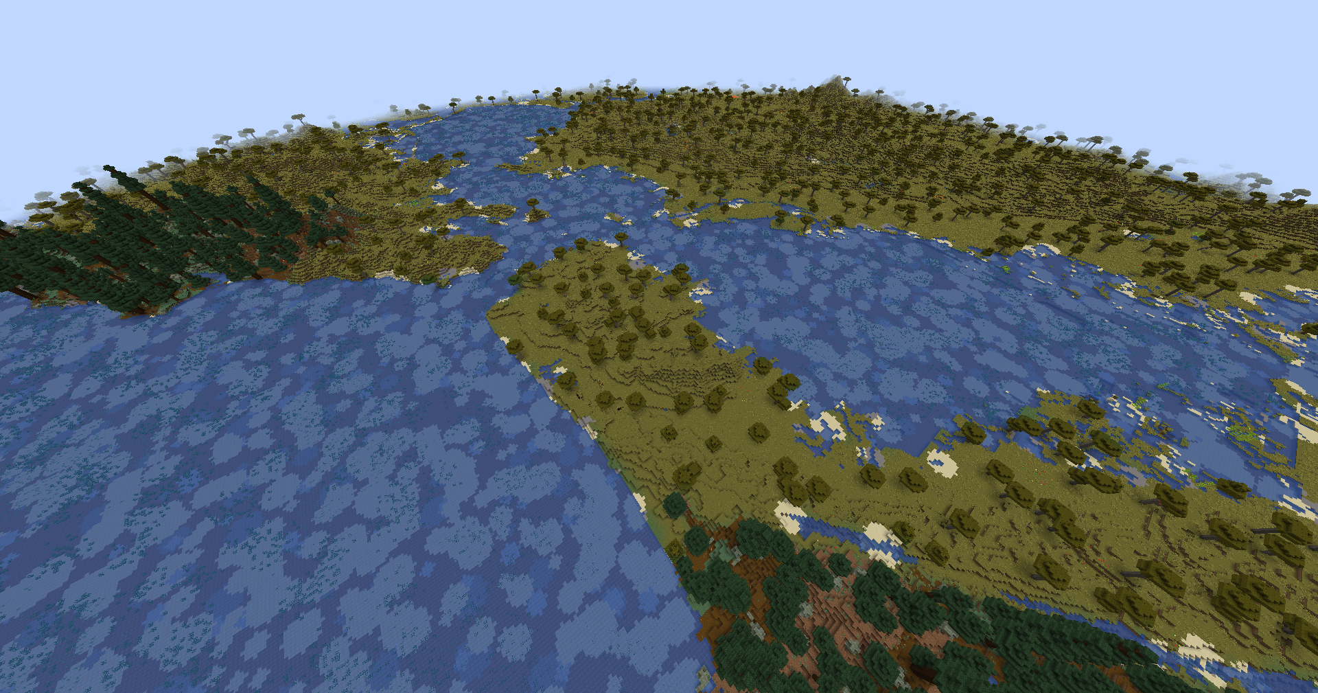 San Francisco (Z=10)
 -
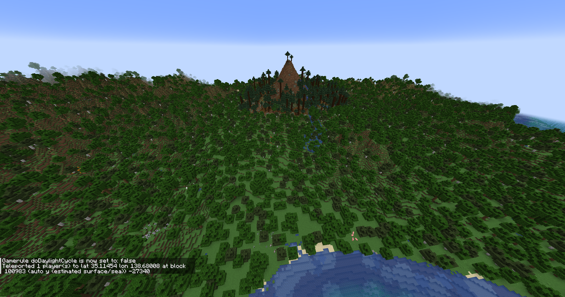 Mt. Fuji (Z=10)
 -
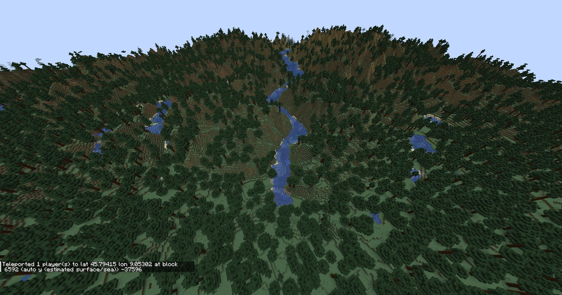 Lake Como (Z=10)
 -
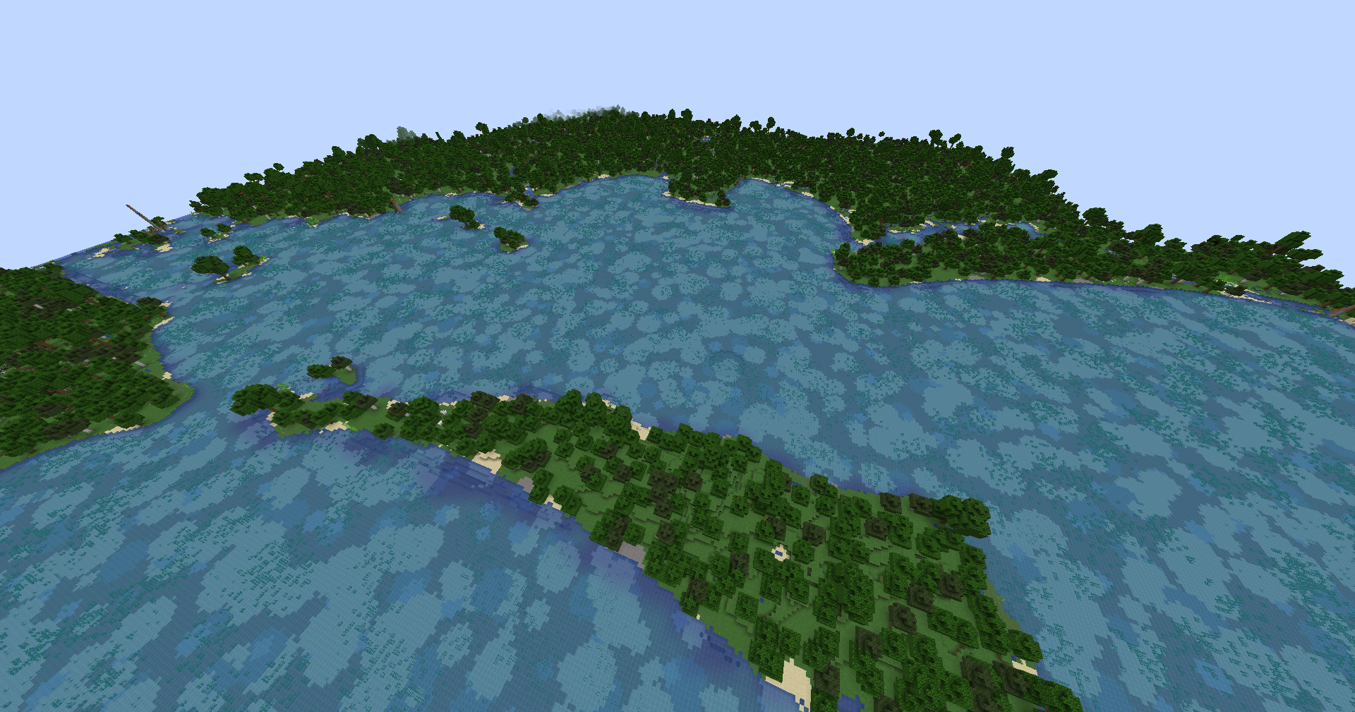 Brisbane (Z=10)
 -
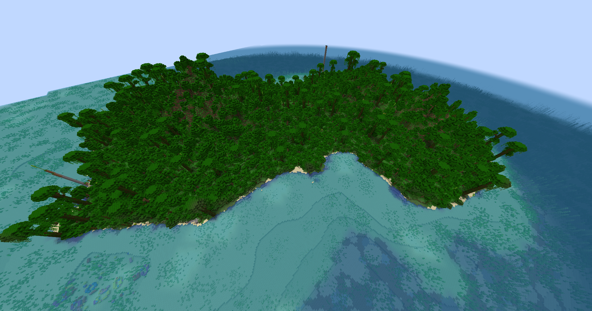 Fernando Po (Z=10)
 -
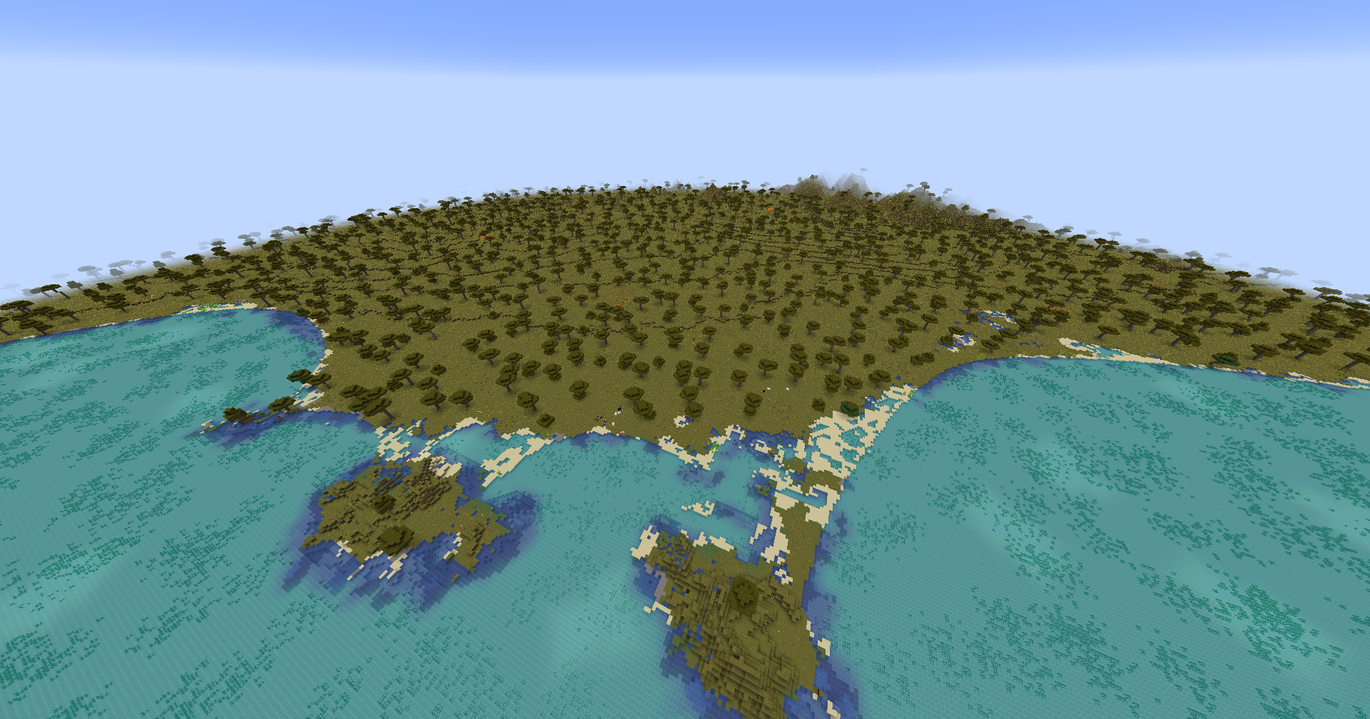 Aden (Z=10)
 -
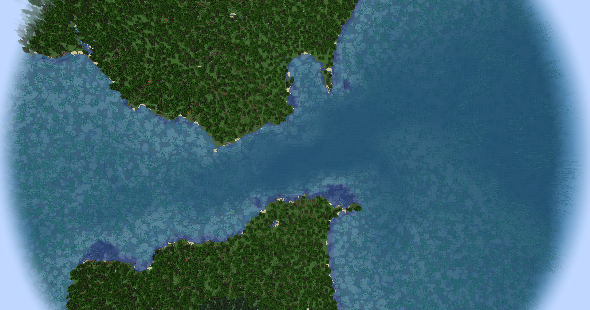 Straight of Gibraltar (Z=10)
 -
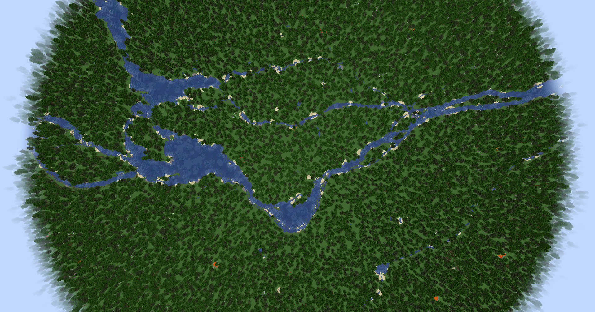 Montreal (Z=10)
 -
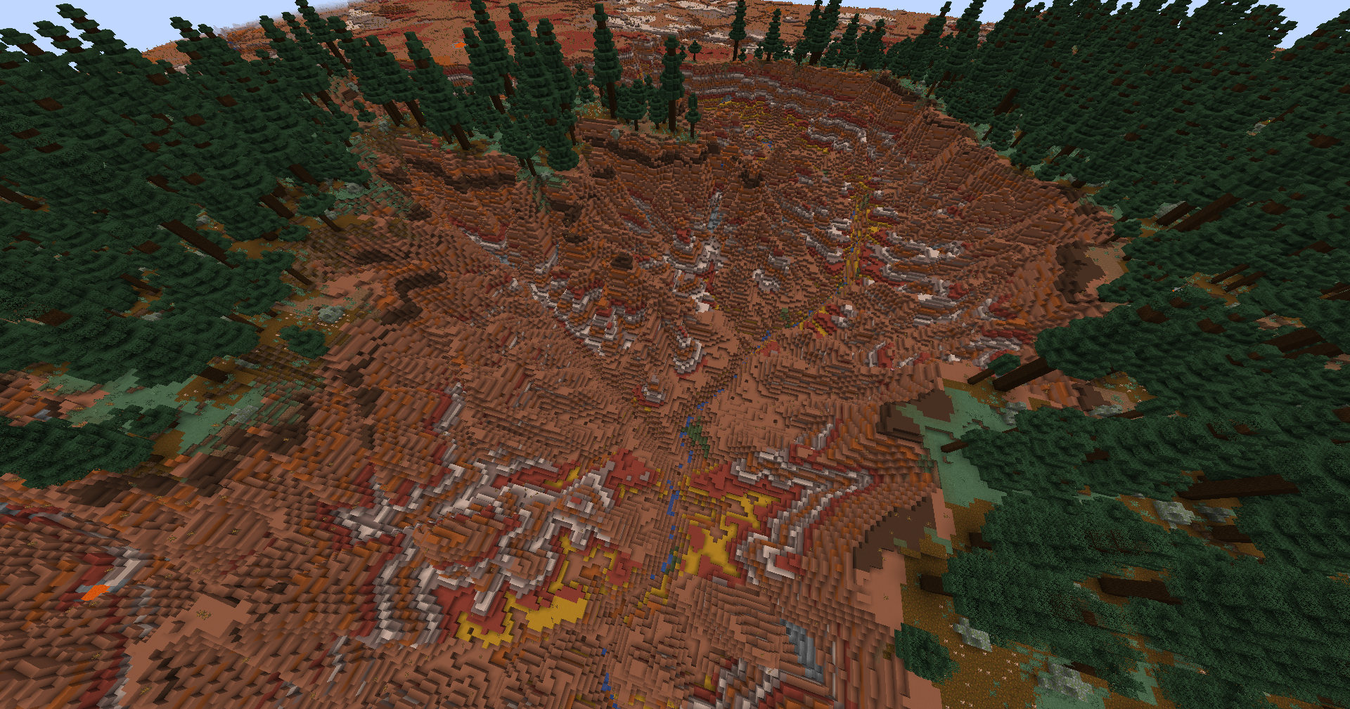 Grand Canyon (Z=10)
 -
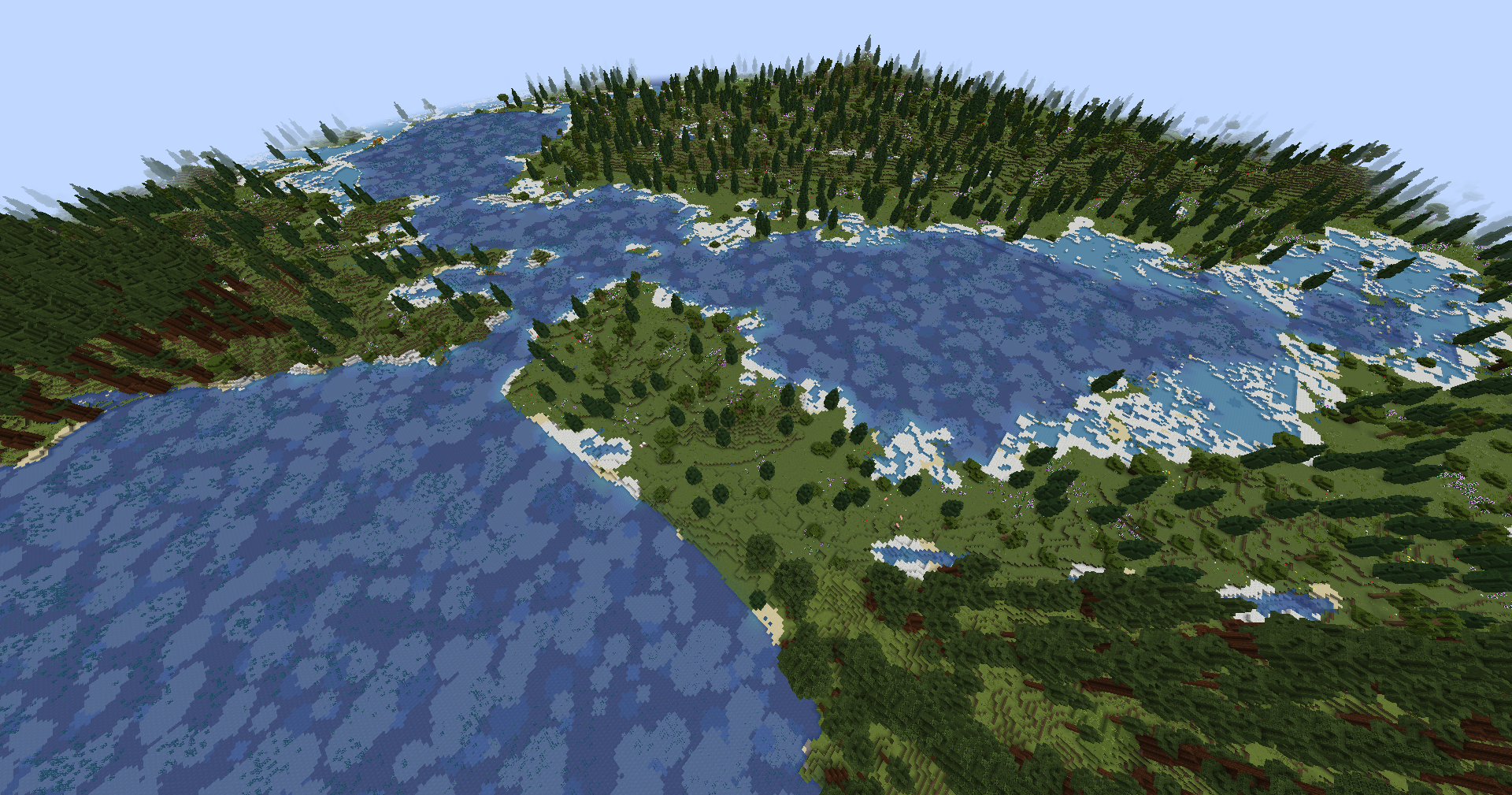 San Francisco (Z=10, Biomes O'Plenty)
 -
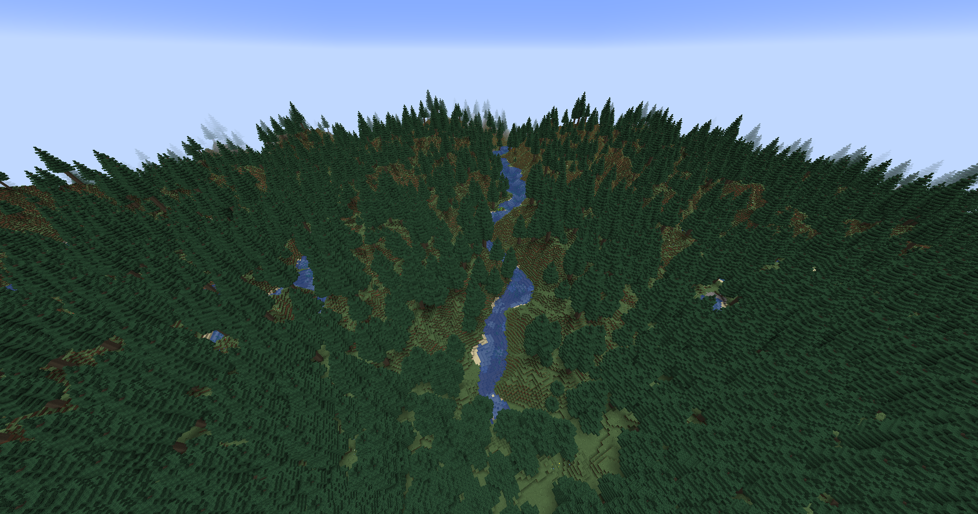 Lake Como (Z=10, Biomes O'Plenty)
 -
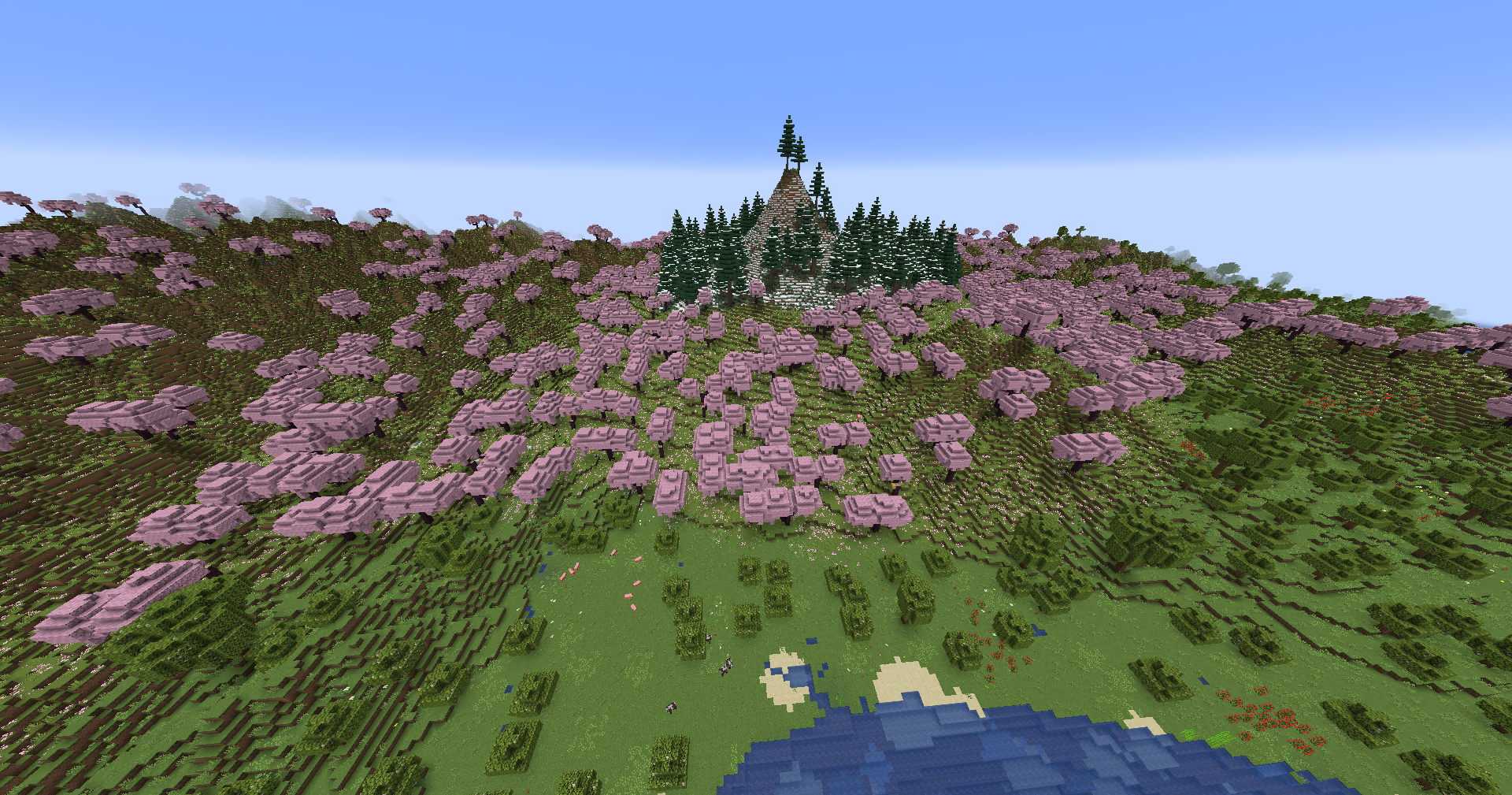 Mt. Fuji (Z=10, Biomes O'Plenty)
 -
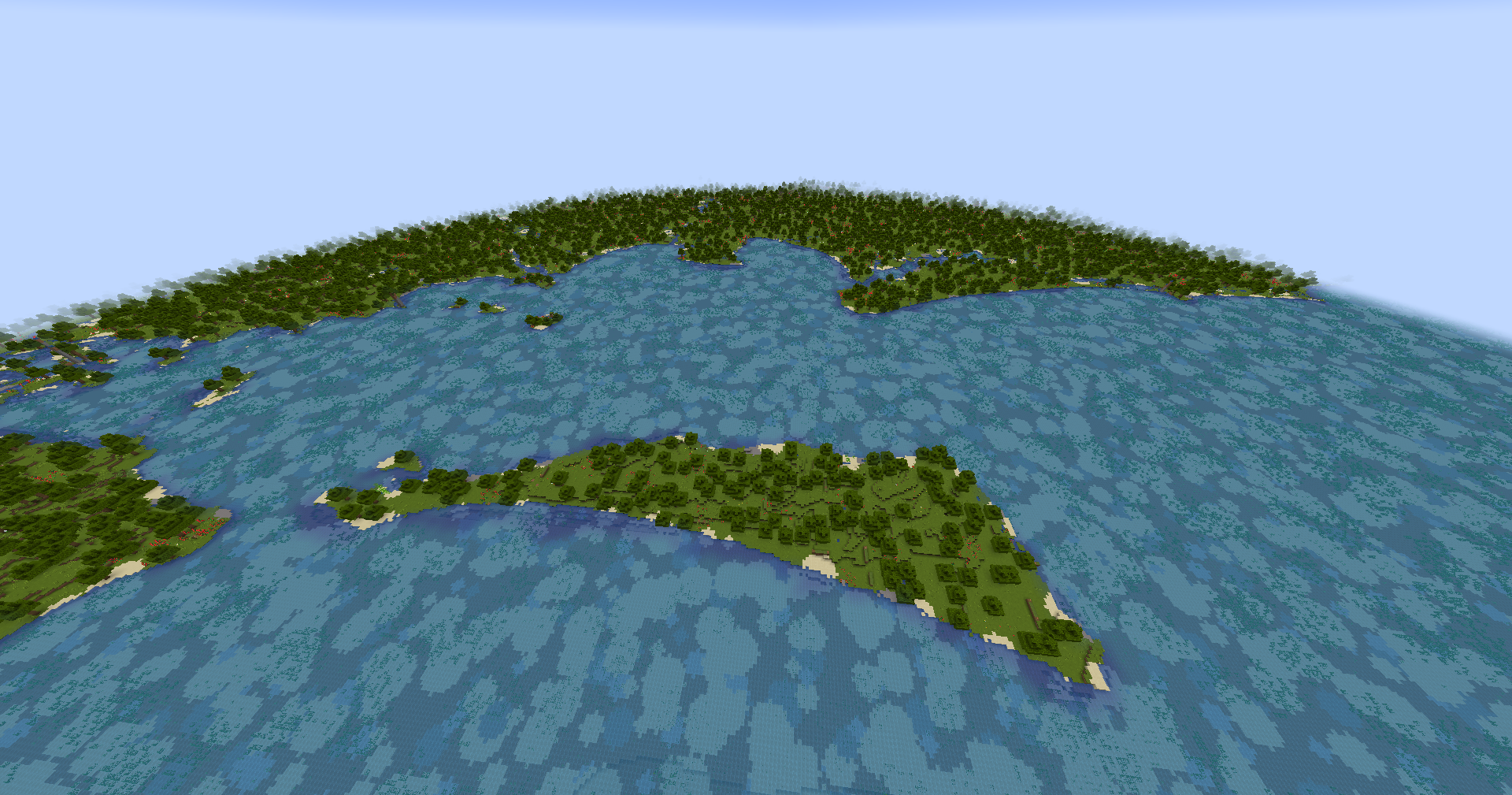 Brisbane (Z=10, Biomes O'Plenty)
 -
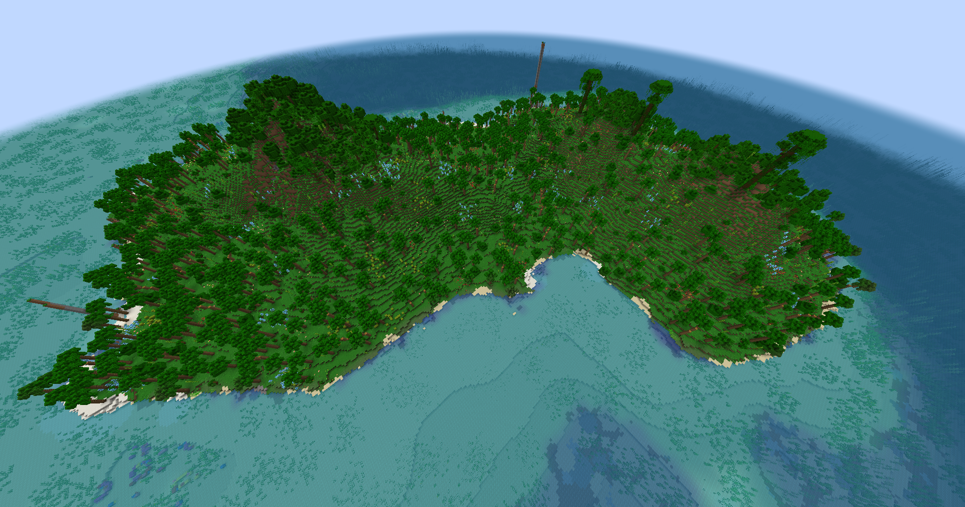 Fernando Po (Z=10, Biomes O'Plenty)
 -
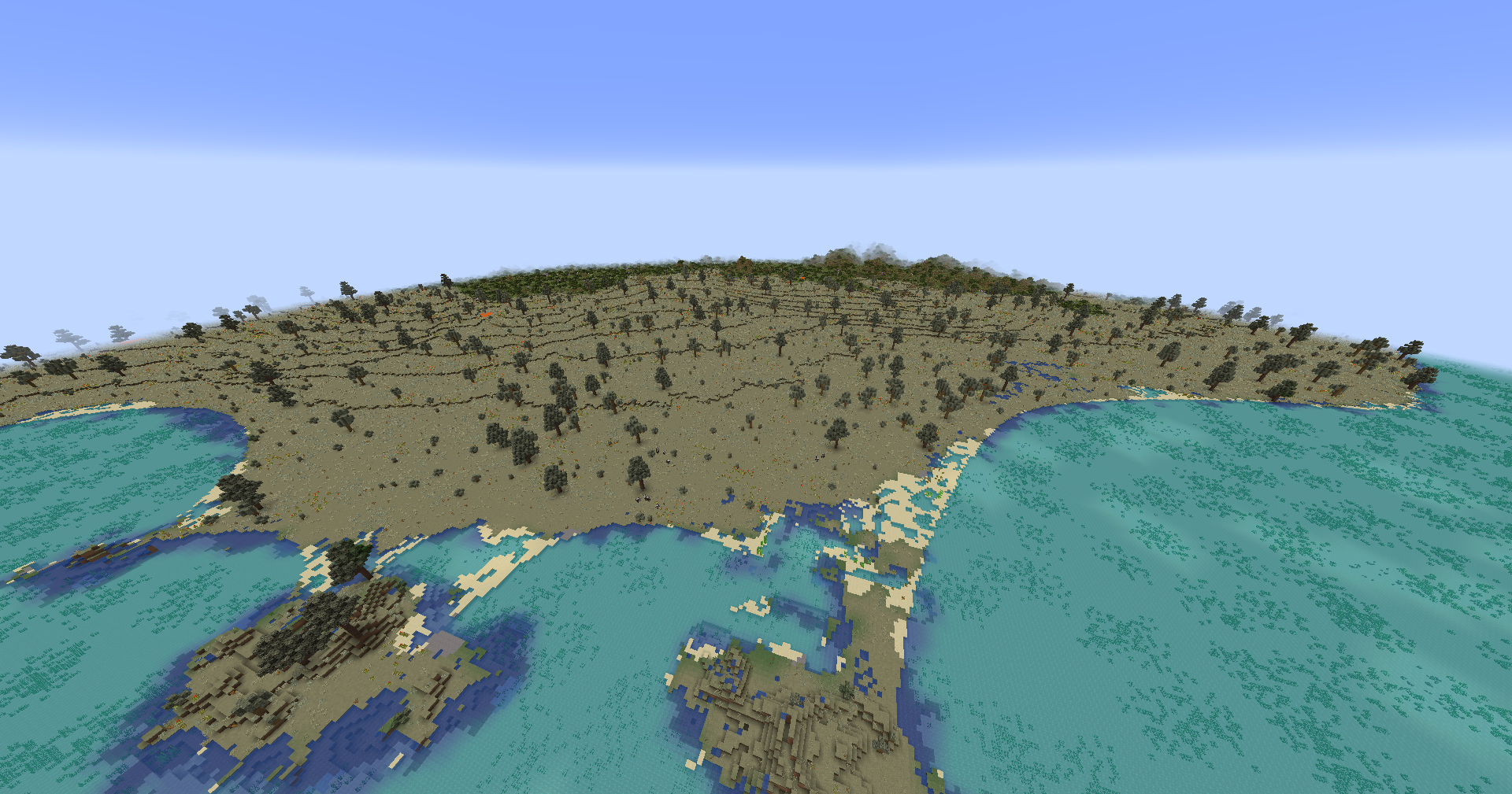 Aden (Z=10, Biomes O'Plenty)
 -
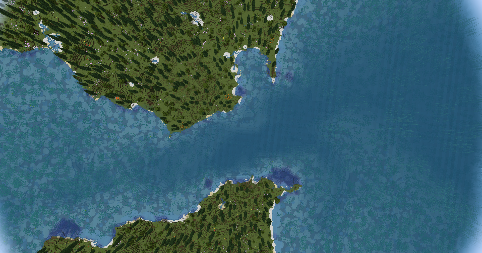 Straight of Gibraltar (Z=10, Biomes O'Plenty)
 -
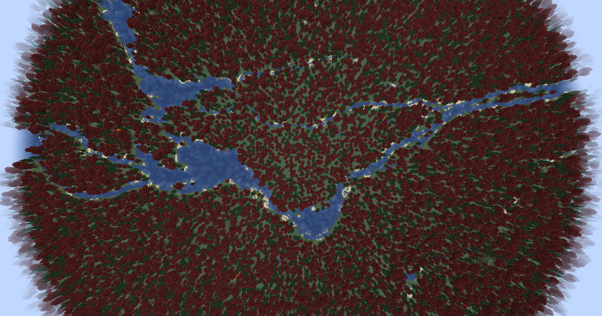 Montreal (Z=10, Biomes O'Plenty)
 -
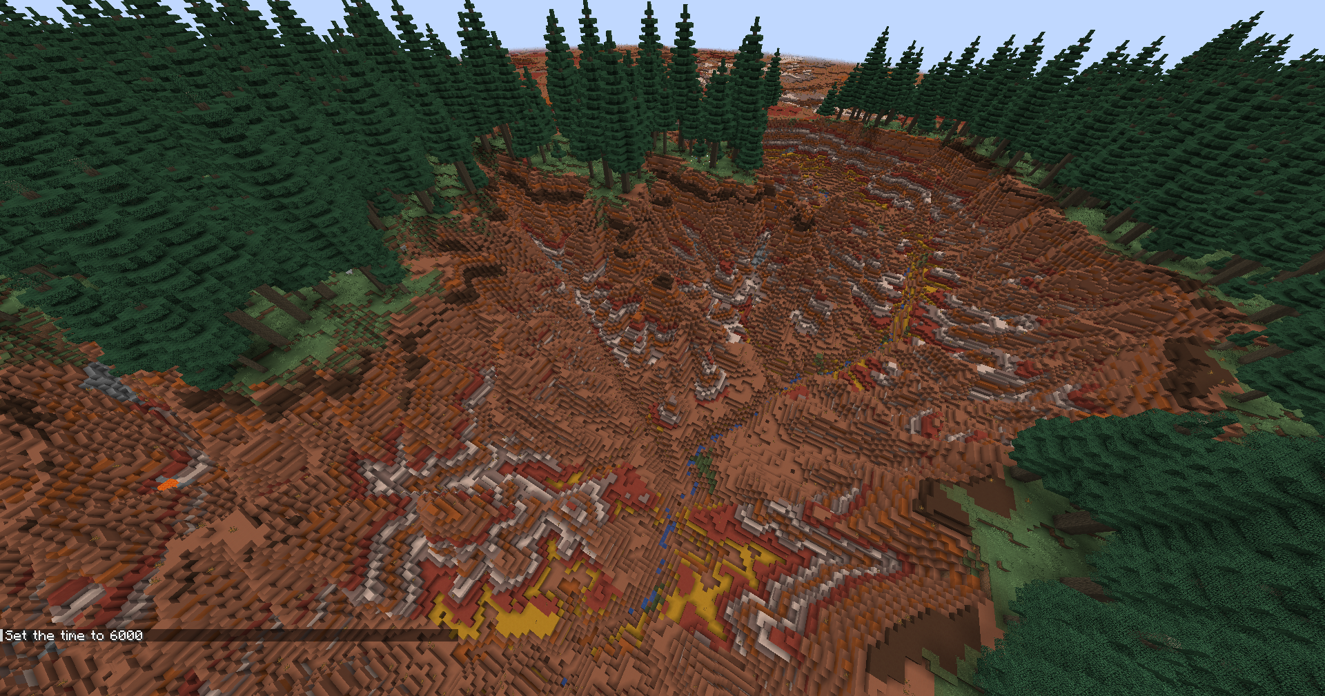 Grand Canyon (Z=10, Biomes O'Plenty)
 -
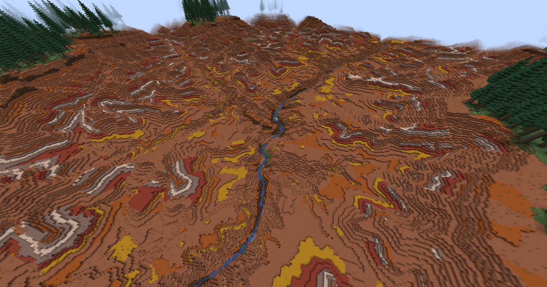 Grand Canyon (Z=12, Biomes O'Plenty)
Versions
Files
Relations
Project Relations
More like this
Similar Mods
Suggestions use data such as tags, dependencies, dependents, descriptions, titles, and more to rank how much they overlap with this mod.
On ModDex
Community snapshot
By the numbers
Statistics
Want to reach Minecraft players?
We're looking for a server hosting partner to feature here and other parts of the site. Interested? Send us a message!
Get in touchGet it on
Available Platforms
On ModDex
Community snapshot
By the numbers
Statistics
Resources