
Community listing page, reviews here may not be monitored by the author.
MrDeadPools Simple GPS with Navigation


No reviews yet
A simple navigation mod, including dimension navigation — provided you have saved portals.
Community voices
Reviews
No reviews yet. Be the first to review this project!
Get it on
Available Platforms
Compatibility
Supported Environments
Must be installed on both the client and the server.
About
Project Details
For authors
Embed Badge
If you're the author of this project, you can embed a live badge anywhere that supports HTML or Markdown. It updates automatically whenever ratings change.
Use HTML for any page that supports it, or Markdown for README files and Markdown-based descriptions.
Identifiers
Platform IDs
Resources
External Links
About
Description
[ENG] A simple navigation mod, including dimension navigation — provided you have saved portals.
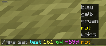
/gps set "name" "x" "y" "z" "Color [Optional]"
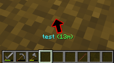
You can start navigation to the specified coordinates .
These coordinates are then saved in the "History," including the dimension. From there, you can, of course, start navigation again, share them, add them to your favorites, or add them to a route (if you wish to create a multi-point route). 50 entries are saved after that, the oldest ones are automatically deleted.
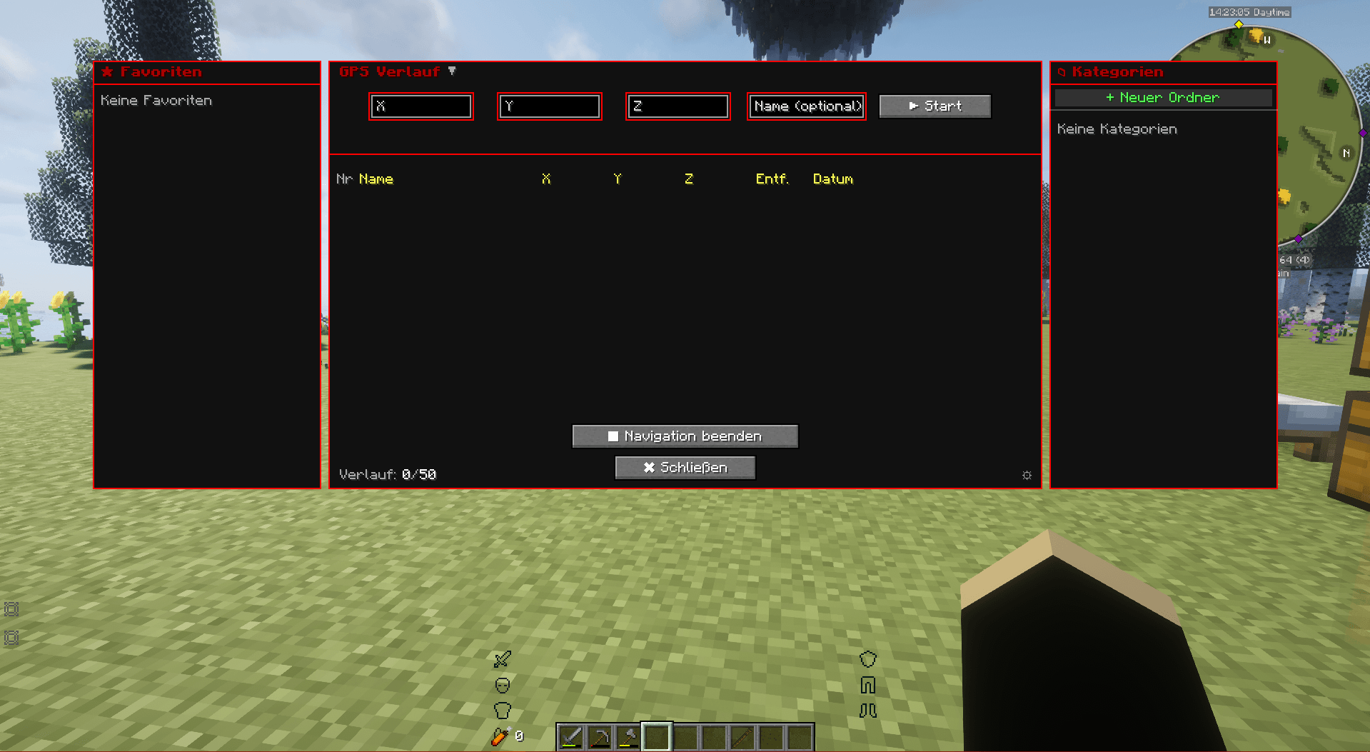
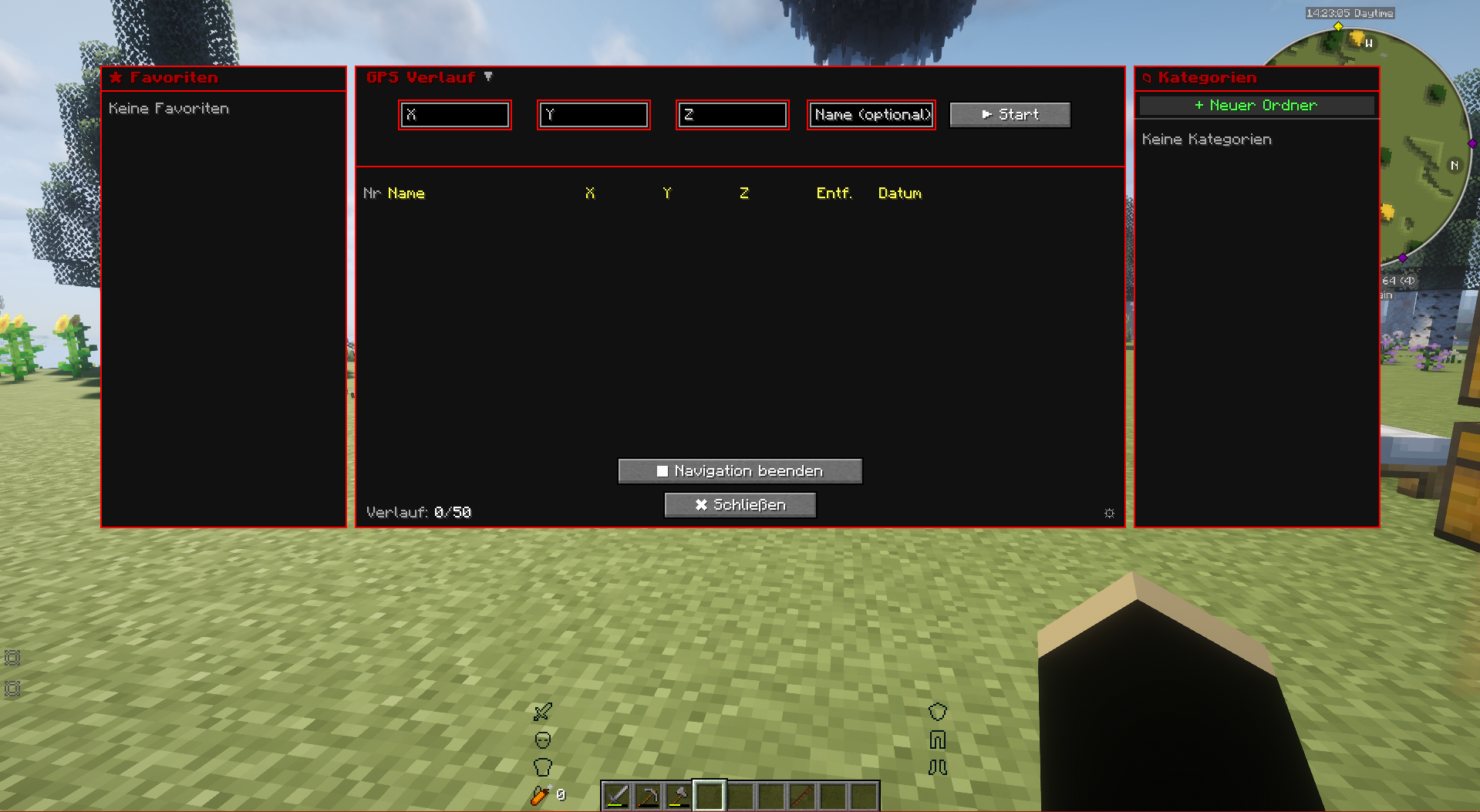
To open the history: press "G" (this can be changed in the options) or /gps history.
You can also start navigation in the History window.
You can create categories on the right side, in which GPS destinations can also be saved by right-clicking within the history window.
/gps share
You can share your current navigation in the chat using `/gps share` or in the GPS GUI by clicking the arrow "[↗]". Any player can then click on the message to start the navigation as well.
/gps end
Ends the current navigation.
[GER] Eine einfache Navigationsmodifikation mit Dimensionsnavigation – vorausgesetzt, du hast Portale gespeichert.
/gps set "Name" "x" "y" "z" "Farbe [Optional]"
Startet eine Navigation zu den angegebenen Koordinaten.
Diese Koordinaten werden dann zusammen mit der Dimension im Verlauf gespeichert. Von dort aus kannst du die Navigation natürlich erneut starten, die Koordinaten teilen, zu deinen Favoriten hinzufügen oder sie einer Route hinzufügen (falls du eine Route mit mehreren Punkten erstellen möchten). Es werden 50 Einträge gespeichert, die ältesten werden automatisch gelöscht.
Um den Verlauf zu öffnen: Drücke "G" (diese Taste kann in den Optionen geändert werden) oder gebe
"/gps history" ein.
Du kannst die Navigation auch direkt im Verlaufsfenster starten.
Auf der rechten Seite kannst du Kategorien erstellen, in denen GPS-Ziele ebenfalls per Rechtsklick im Verlaufsfenster gespeichert werden können.
/gps share
Du kannst deine aktuelle Navigation im Chat mit `/gps share` oder in der GPS-Benutzeroberfläche durch Klicken auf den Pfeil "[↗]" teilen. Jeder Spieler kann dann auf die Nachricht klicken, um die Navigation ebenfalls zu starten.
/gps end
Beendet die aktuelle Navigation

[ENG] A simple navigation mod, including dimension navigation — provided you have saved portals.
/gps set "name" "x" "y" "z" "Color [Optional]"
You can start navigation to the specified coordinates .
These coordinates are then saved in the "History," including the dimension. From there, you can, of course, start navigation again, share them, add them to your favorites, or add them to a route (if you wish to create a multi-point route). 50 entries are saved after that, the oldest ones are automatically deleted.
To open the history: press "G" (this can be changed in the options) or /gps history.
You can also start navigation in the History window.
You can create categories on the right side, in which GPS destinations can also be saved by right-clicking within the history window.
/gps share
You can share your current navigation in the chat using /gps share or in the GPS GUI by clicking the arrow "[↗]". Any player can then click on the message to start the navigation as well.
/gps end
Ends the current navigation.
[GER] Eine einfache Navigationsmodifikation mit Dimensionsnavigation – vorausgesetzt, du hast Portale gespeichert.
/gps set "Name" "x" "y" "z" "Farbe [Optional]"
Startet eine Navigation zu den angegebenen Koordinaten.
Diese Koordinaten werden dann zusammen mit der Dimension im Verlauf gespeichert. Von dort aus kannst du die Navigation natürlich erneut starten, die Koordinaten teilen, zu deinen Favoriten hinzufügen oder sie einer Route hinzufügen (falls du eine Route mit mehreren Punkten erstellen möchten). Es werden 50 Einträge gespeichert, die ältesten werden automatisch gelöscht.
Um den Verlauf zu öffnen: Drücke "G" (diese Taste kann in den Optionen geändert werden) oder gebe "/gps history" ein.
Du kannst die Navigation auch direkt im Verlaufsfenster starten.
Auf der rechten Seite kannst du Kategorien erstellen, in denen GPS-Ziele ebenfalls per Rechtsklick im Verlaufsfenster gespeichert werden können.
/gps share
Du kannst deine aktuelle Navigation im Chat mit /gps share oder in der GPS-Benutzeroberfläche durch Klicken auf den Pfeil "[↗]" teilen. Jeder Spieler kann dann auf die Nachricht klicken, um die Navigation ebenfalls zu starten.
/gps end
Beendet die aktuelle Navigation
Screenshots
Gallery
-
 Screenshot_3.png Screenshot_3.png
 -
 Screenshot_2.png Screenshot_2.png
 -
 Screenshot_1.png Screenshot_1.png
-
 Gui
Gui -
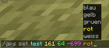 Command
 -
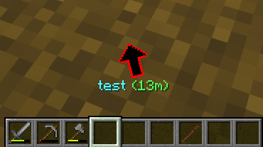 Navigation
Versions
Files
Relations
Project Relations
More like this
Similar Mods
Suggestions use data such as tags, dependencies, dependents, descriptions, titles, and more to rank how much they overlap with this mod.
On ModDex
Community snapshot
By the numbers
Statistics
Want to reach Minecraft players?
We're looking for a server hosting partner to feature here and other parts of the site. Interested? Send us a message!
Get in touchGet it on
Available Platforms
On ModDex
Community snapshot
By the numbers
Statistics
Resources