
Community listing page, reviews here may not be monitored by the author.
Roleplayer's Atlas

No reviews yet
A hand-drawn atlas for roleplay servers. Draw territories, roads, inscriptions and whole player-built towns, correct the biomes it guessed wrong, and sign and date maps to hand to other players. Client-side, no server mod.
Community voices
Reviews
No reviews yet. Be the first to review this project!
Get it on
Available Platforms
Compatibility
Supported Environments
Runs entirely on the client. Works on vanilla servers.
About
Project Details
For authors
Embed Badge
If you're the author of this project, you can embed a live badge anywhere that supports HTML or Markdown. It updates automatically whenever ratings change.
Use HTML for any page that supports it, or Markdown for README files and Markdown-based descriptions.
Identifiers
Platform IDs
About
Description
Roleplayer's Atlas
A hand-drawn atlas for roleplay servers. Territories, roads, quill inscriptions, dated marks, and maps you sign and hand to another player.
A fork of Antique Atlas 4 by Sisby folk, rebuilt around one idea: on a roleplay server a map isn't a HUD, it's a document. You draw it, you sign it, you date it, and you give it to someone who then knows the place only by your word – until they go and see it for themselves.
Client-side only. The server needs no mod, which is the point: most roleplay servers run plugin cores you can't add mods to. Surveyor Map Framework rides inside the jar, so there is nothing else to install.
The book opens in two stages
Press [M] once and the book is drawn into your hands, held open in front of you. You keep walking, keep looking around, keep whatever is in your main hand, and the map is simply there, tilting as you turn. This is the stage you travel with.
Press it again and the book is put away and the full page opens, where you drag to pan, scroll to zoom, and draw with the tools down the right edge. This is the stage you work on.
A third press closes it.
Drawing on the world
Territories. Paint an area cell by cell, name it, and the name appears written across the land in the old cartographic style. Walking in can announce it on screen. Redraw the bounds later without starting again.
Roads. Click out a path and it becomes a curving dashed track with its name written along the curve, and its length on hover. Pick an old road back up at its far end and carry it on.
Quill inscriptions. Free text anywhere on the map, no icon – for what a place is called rather than what stands there.
Hand-drawn towns. The atlas draws villages the game tells it about. A town players built is invisible to it, so draw it yourself, from the same box of pieces the villages use: roads, crossroads, wells, houses, farms, market stalls, lamps. Nothing about the land underneath is changed, and any of it lifts again.
Biome corrections. The atlas guesses at biomes it has no drawing for, and a datapack server gives it plenty to guess at. When a guess is wrong, overrule it – draw one biome as another everywhere, or correct named cells one at a time.
Undo and redo, twenty steps deep, across every drawing tool.
Marks that are worth something
Dating. Every mark records the day it was drawn. The day comes from the world's game time rather than its time of day, because a server can freeze the day cycle or hand each player their own. Game time keeps ticking and reads the same for everyone.
Layers. Your own layers with names and colours, filtered by tabs down the left edge. Deaths get one automatically.
Notes and search. Any mark can carry a note, and the magnifier searches names and notes alike. The tab below reorders the list: by kind, nearest first, newest first, or alphabetically.
Place names on screen. Come near a named mark and its name fades in over the world, the way vanilla announces a biome. How near is set per mark or once for all of them, with an optional chime. Territories announce by standing inside them, and the smallest one containing you wins – walk into a duchy inside a kingdom and it is the duchy you are told you are in. Marks on hidden layers stay quiet, and any mark can have it switched off on its own.
Quick marks. One key marks a place without opening anything – under your feet, or wherever you are looking, so a peak on the horizon can be marked from the valley you stand in.
Guide arrows. Track a mark and an arrow points at it with the distance. It drops itself when you arrive.
The hearth. Your respawn point, marked automatically, read from the same packet the vanilla compass follows. Works with beds, respawn anchors, /spawnpoint, and plugins that set a real respawn point.
Maps you hand over
Export a slice of your atlas – terrain, chosen marks, inscriptions, territories, roads, your biome corrections and your towns – into an .atlas scroll, and give the file to another player.
Signed scrolls carry your name and the date. On the other side those marks arrive faint, filed into a layer named after you, captioned "As told by …". They stay faint until that player has physically walked to the spot, at which point the mark firms up and records the day it was seen.
Your corrections and towns land as a sheet under your name. That sheet never overrules anything the reader drew themselves, and it can be torn out whole. Before any of it is written, the reader sees exactly what the scroll holds and can decline.
Snapshots to a PNG. The map also comes out of the game as an image, written to your screenshots folder like any other. Two kinds: the page as you are looking at it, or the whole explored world stitched together at full tile resolution – and that second one is a poster rather than a screenshot, running to tens of thousands of pixels on a side for a well-travelled world. Either can be framed like a hung item frame and signed with your name and the date. Post it, print it, hang it in a Discord.
Settings
config/roleplayers-atlas.toml, or in-game through Mod Menu. With Cloth Config the settings screen is the searchable one; without either, the file still works and a plainer screen is built in.
Elevation tiers, unexplored land, death markers and their wording, place names on screen, guide arrows, the hearth, the quick-mark key and its icon, fullscreen, remembered zoom and position.
Scrolls, layers, corrections and tracked marks live in config/roleplayers-atlas/.
Credit
This is a fork, and almost all of the foundation is someone else's work.
Antique Atlas was created by Hunternif, continued by Kenkron, asie and tyra314, and rewritten as Antique Atlas 4 by Sisby folk. Surveyor Map Framework, which this cannot run without, is theirs as well.
Surveyor has no 1.21.11 build of its own – its 1.21 line ends at 1.21.8, after which it moved to 26.1. The 1.21.11 file here therefore carries a modified copy of Surveyor, ported by hand and versioned 1.2.1+1.21.11-ra.1 so it cannot be mistaken for an official build. It stays under LGPL-3.0-or-later, and its source is on Codeberg. Anything wrong with that build is this mod's fault, not Sisby folk's – report it here.
The map art is by Hunternif and lumiscosity – the CREDITS file names every texture and who drew it.
LGPL-3.0-or-later for code, CC BY-NC-SA for assets, inherited from upstream and unchanged. Both are copyleft: anything adapted from this has to carry the same terms.
Screenshots
Gallery
-
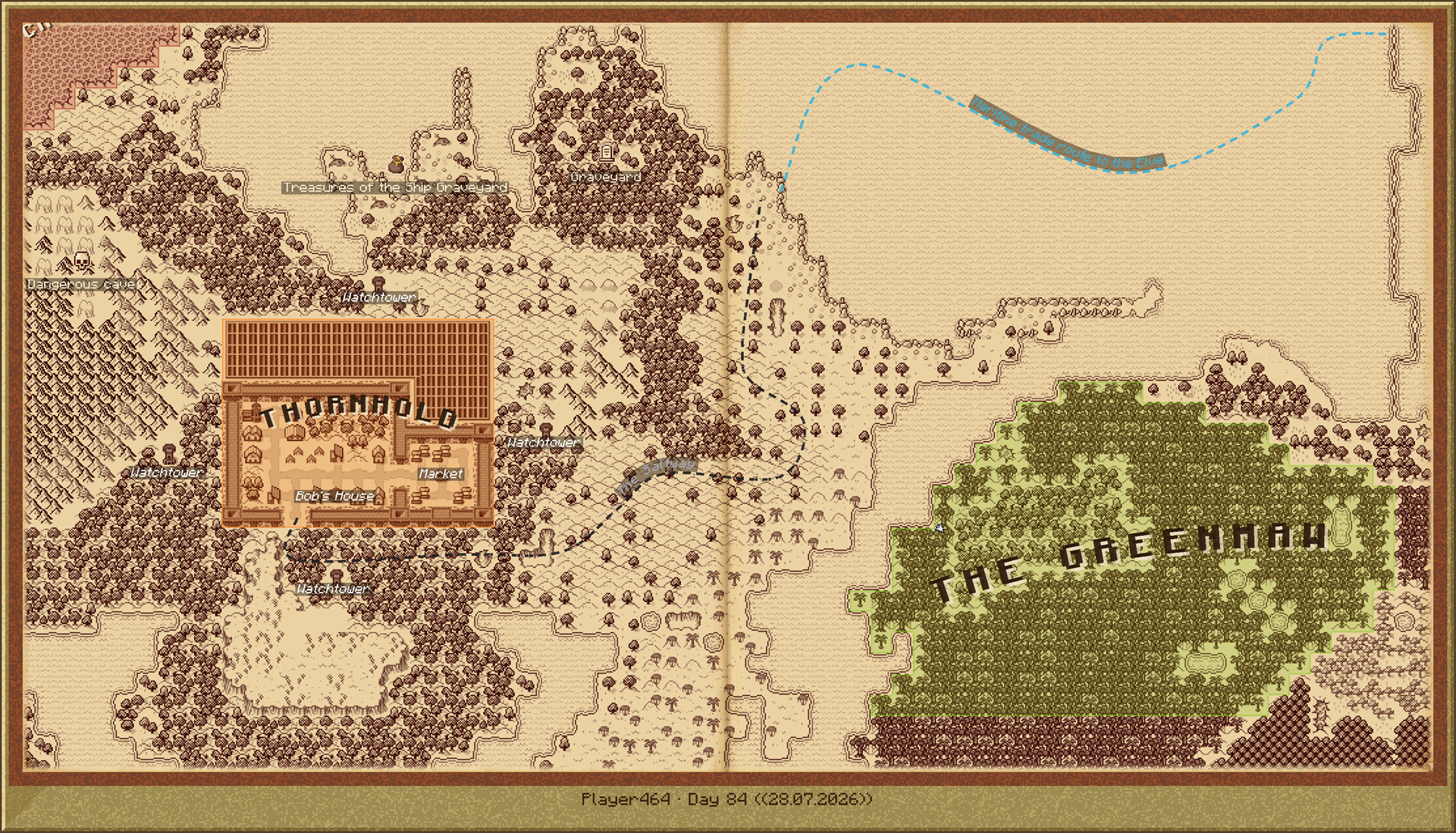 The whole map, saved out as an image The full explored world exported to a PNG, framed and signed with the cartographer name and the day.
 -
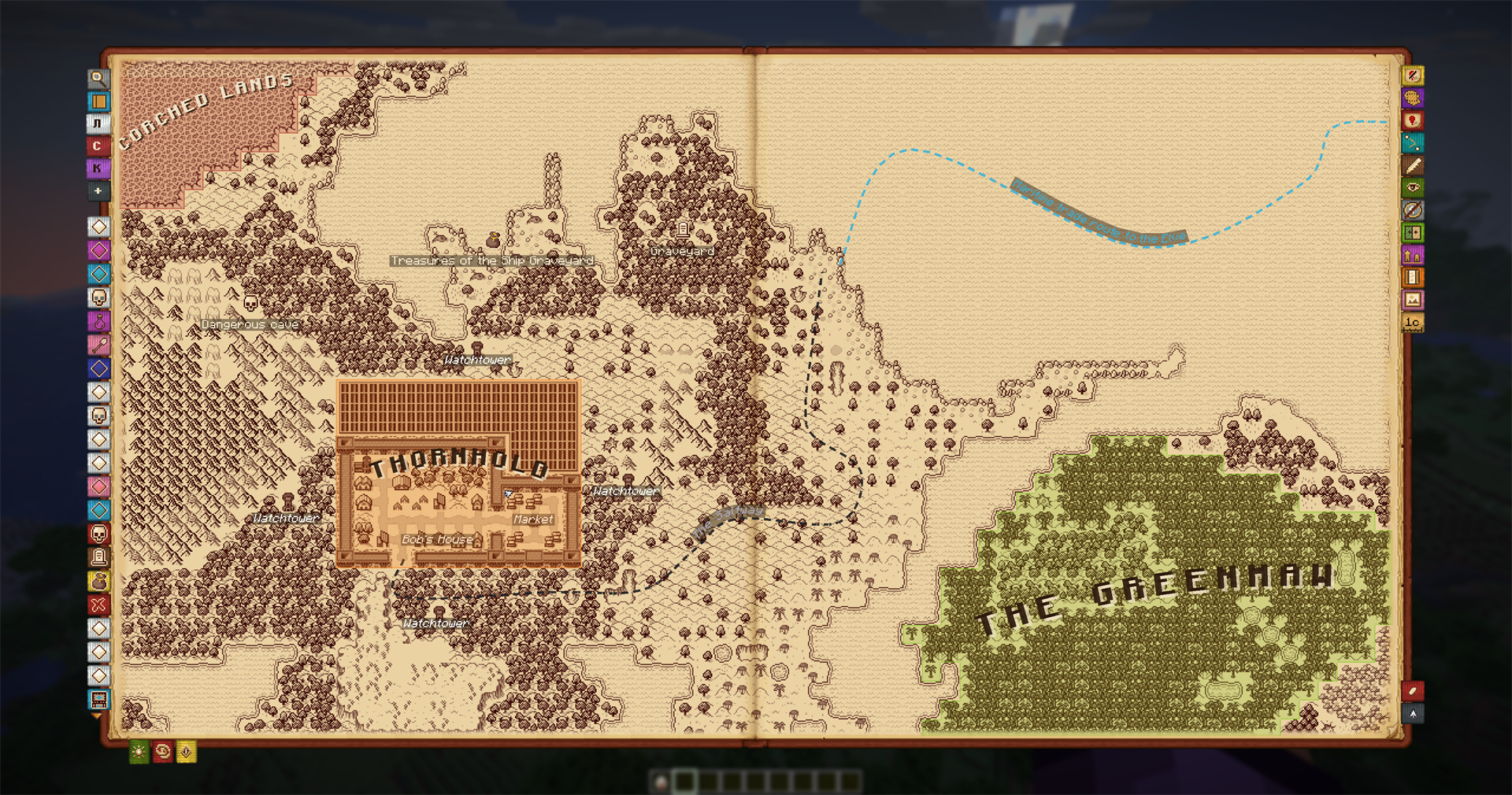 Territories, roads and inscriptions Named territories written across the land, a road drawn through clicked points, and marks with their own icons.
 -
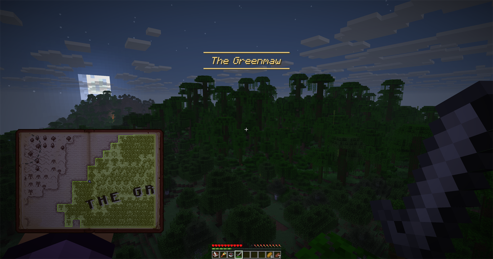 Place names announce themselves Walking into a named territory announces it on screen, with the atlas held open in your hands.
 -
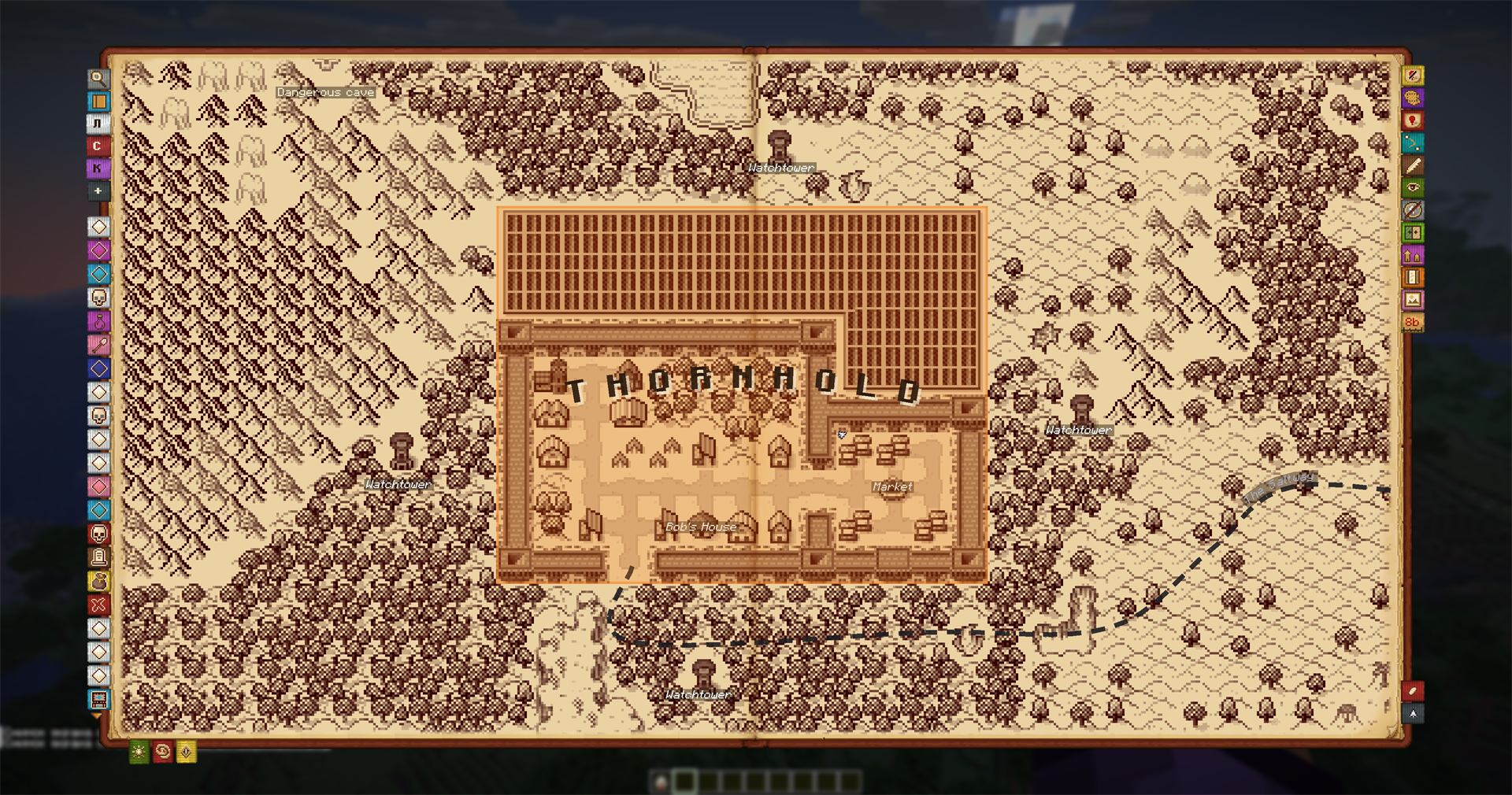 A town drawn by hand Roads, houses, a market and a well, painted cell by cell over the real terrain.
 -
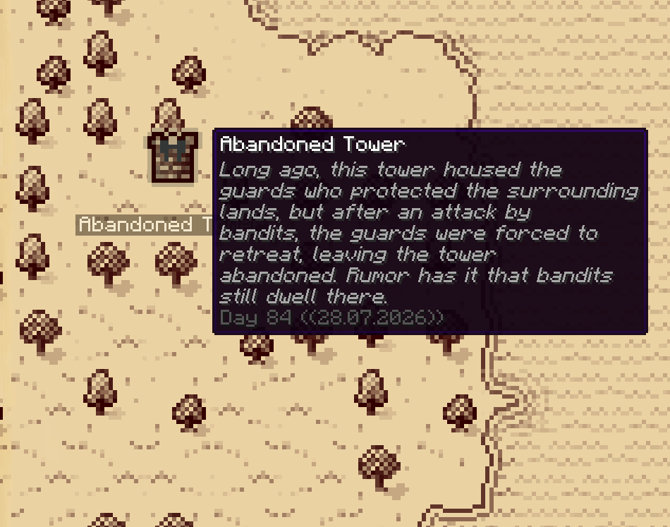 Marks that carry a story A name, a note and the day it was drawn on.
 -
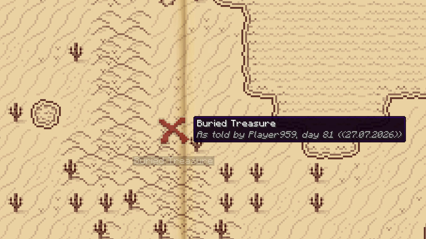 Hearsay from another player A mark off someone else stays faint and captioned until you go and see it yourself.
 -
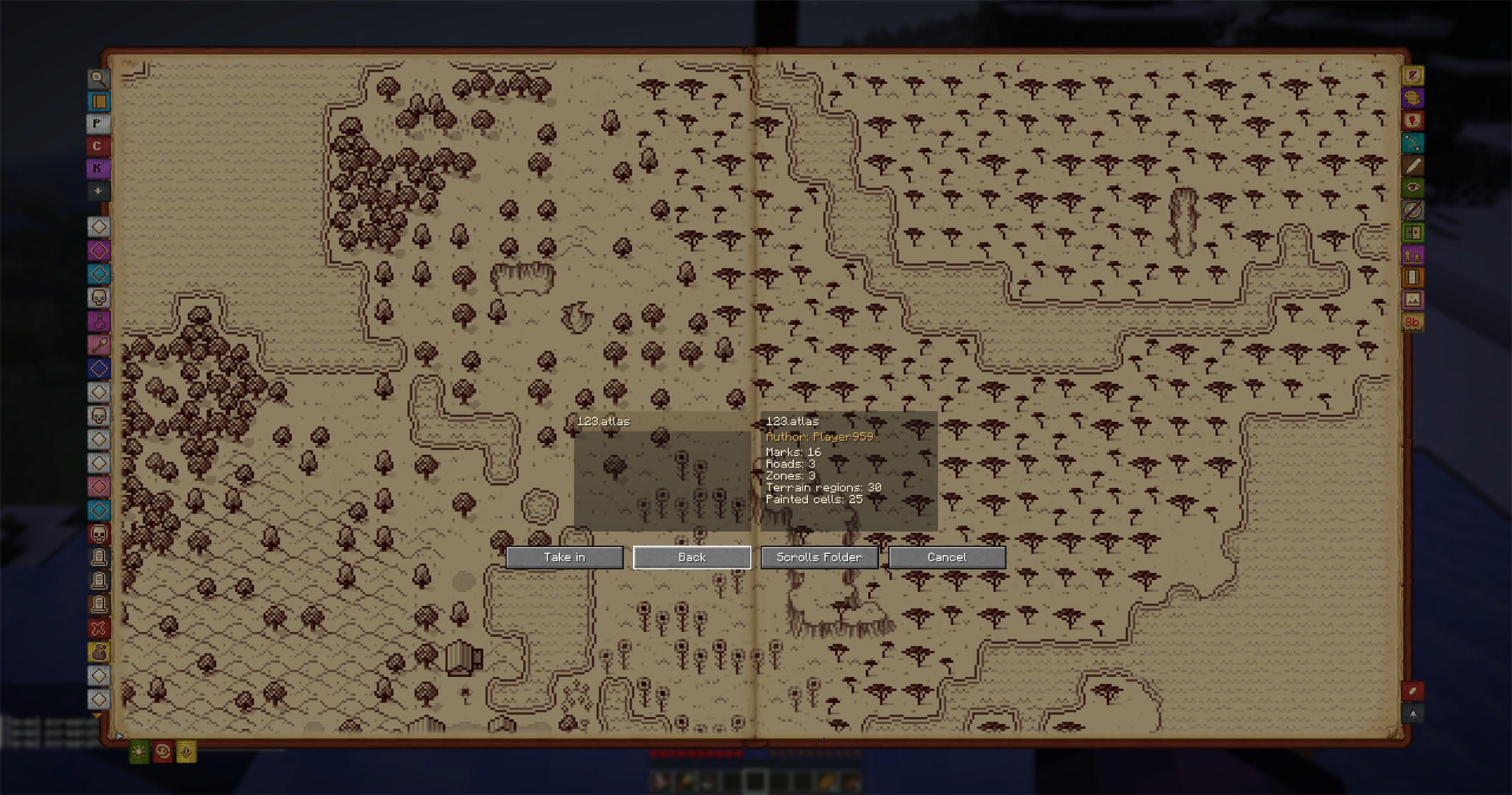 See a scroll before you take it in Whose hand it is and exactly what it holds, read without writing a word of it to your own map.
 -
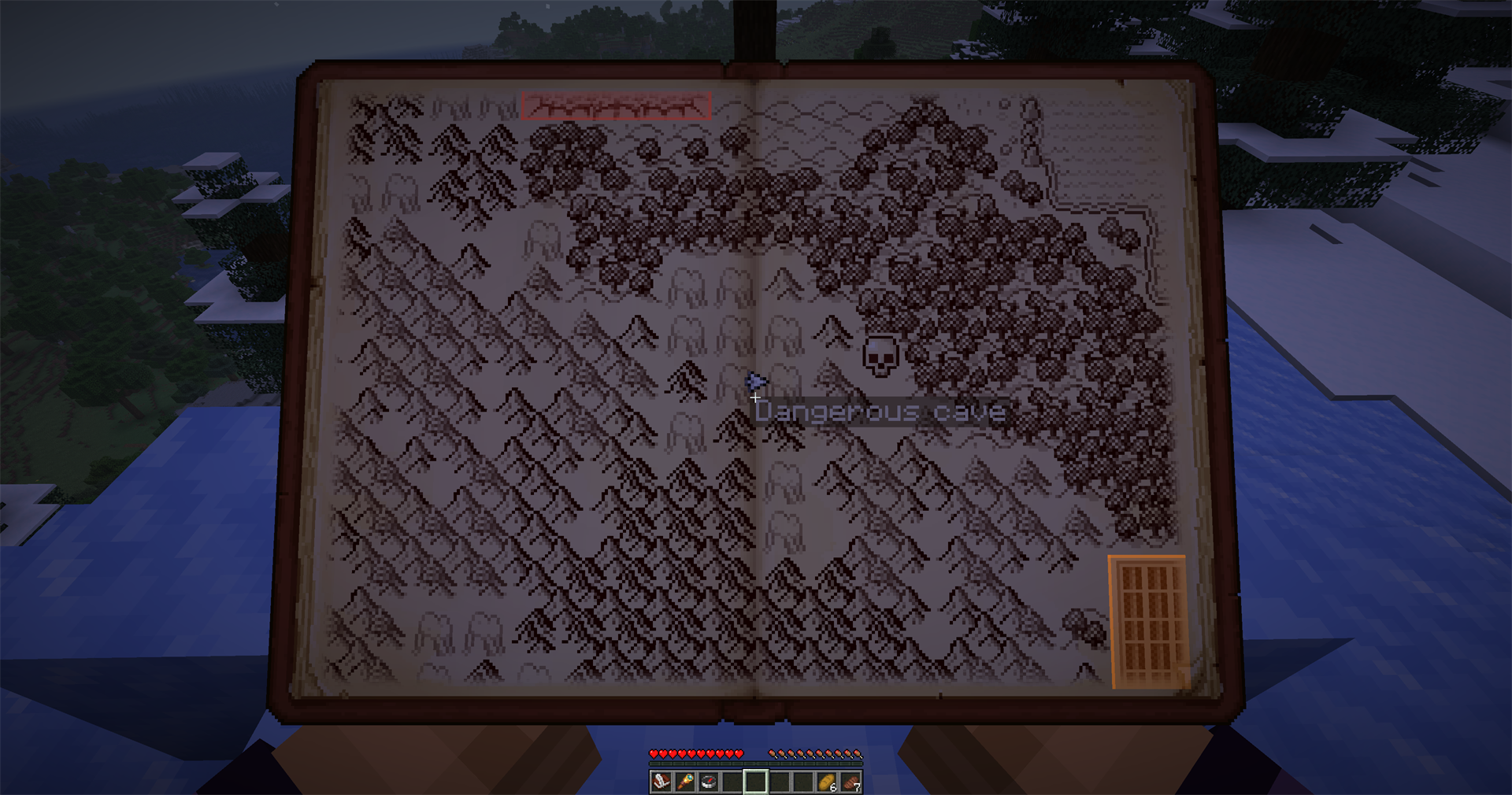 The book travels with you One press puts it in your hands and you keep walking; a second opens the full page.
 -
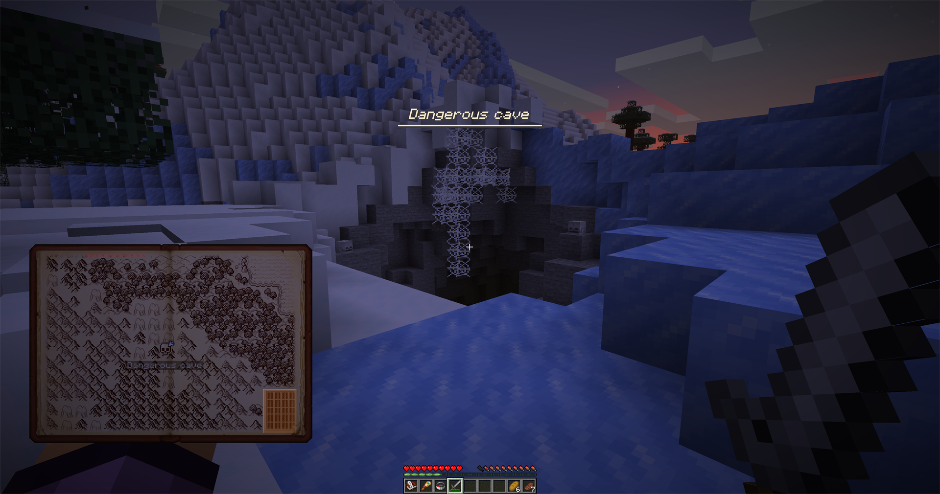 A mark you set announcing itself Any named mark can call out as you come near, with the radius set per mark.
 -
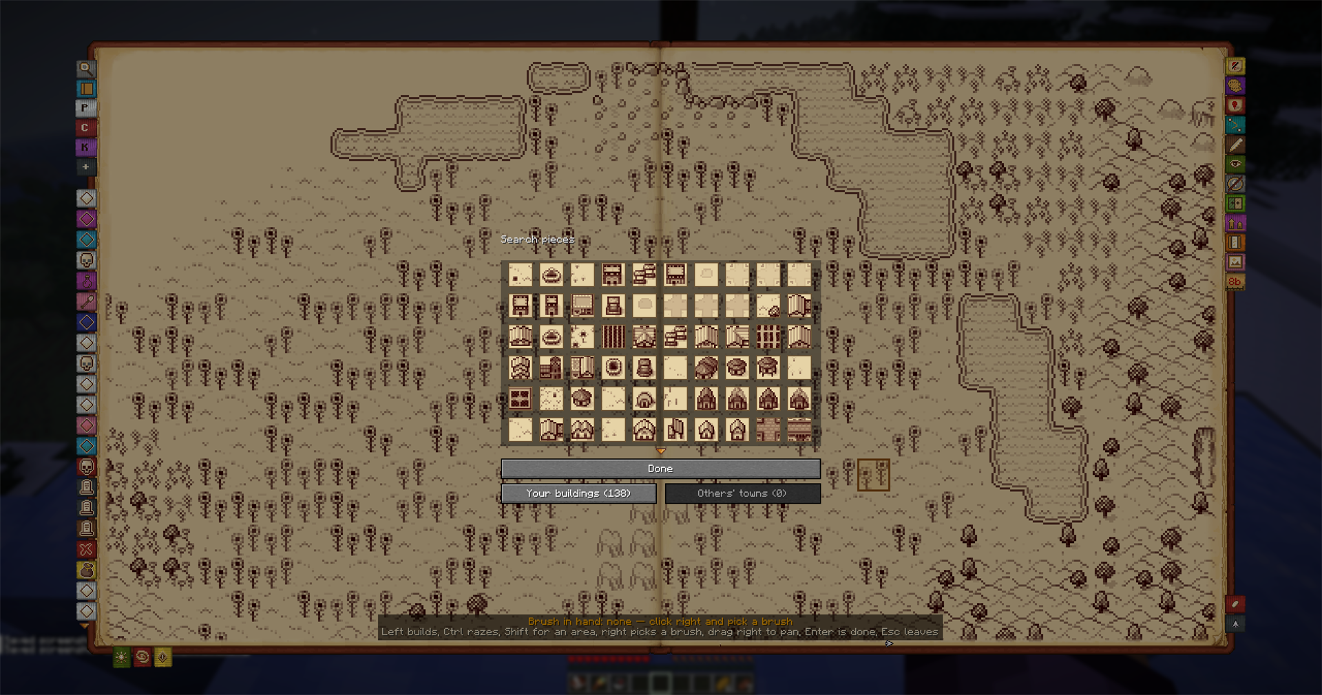 The box of town pieces Roads, crossroads, wells, houses, farms and market stalls, the same set the villages are drawn with.
 -
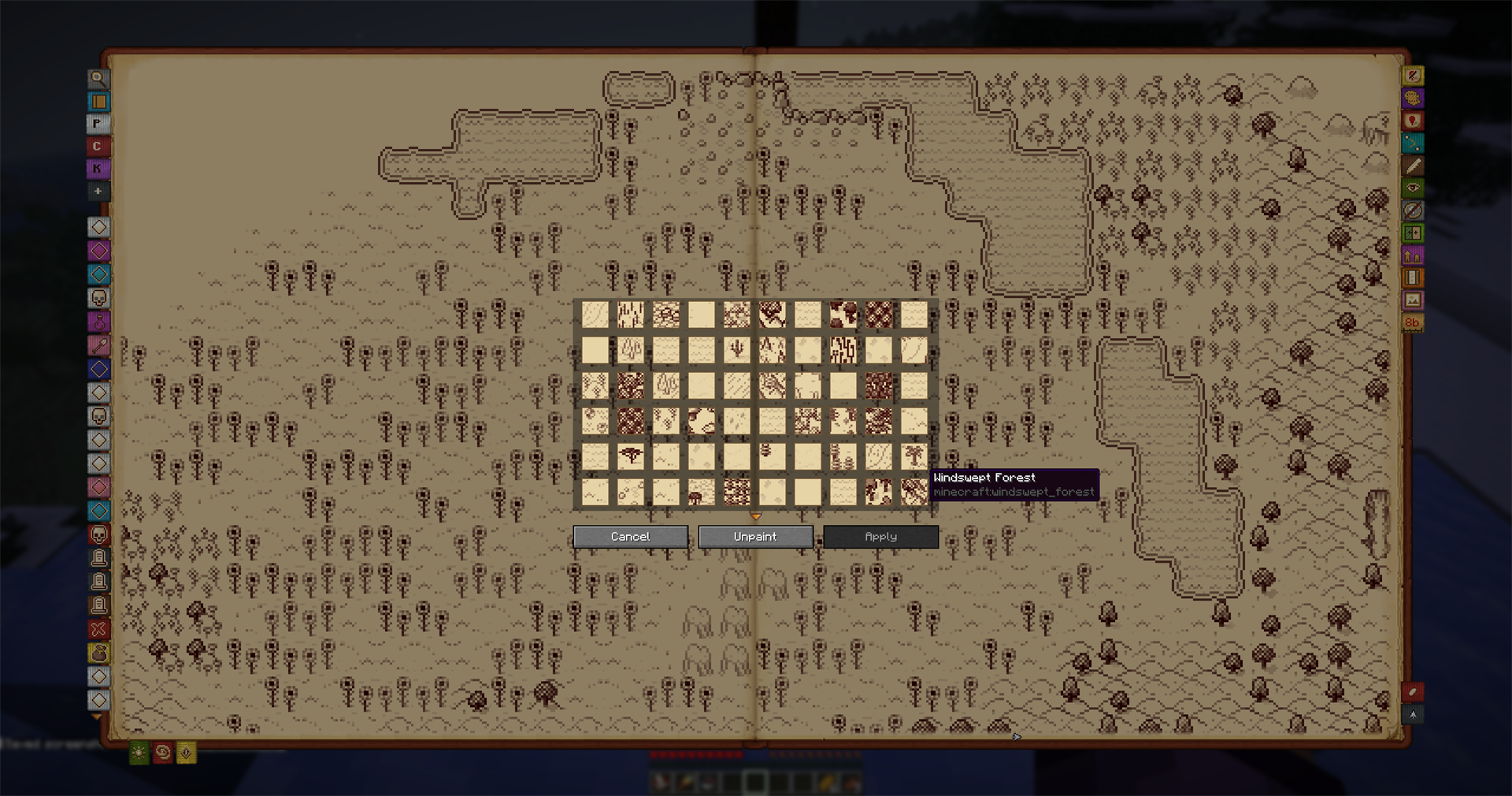 Correcting a biome the atlas guessed wrong Every tile design the atlas has, to overrule a guess on a datapack biome.
 -
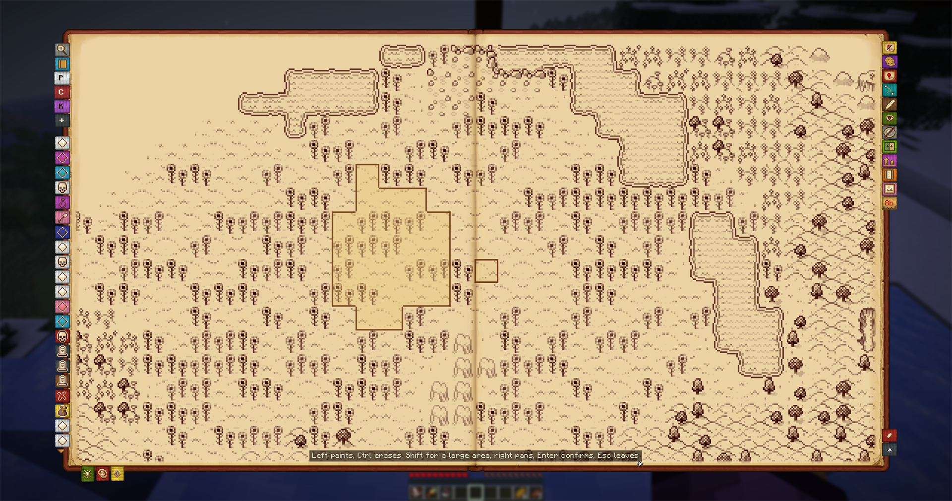 Painting a territory Mark out the ground cell by cell; the controls are written at the foot of the page.
 -
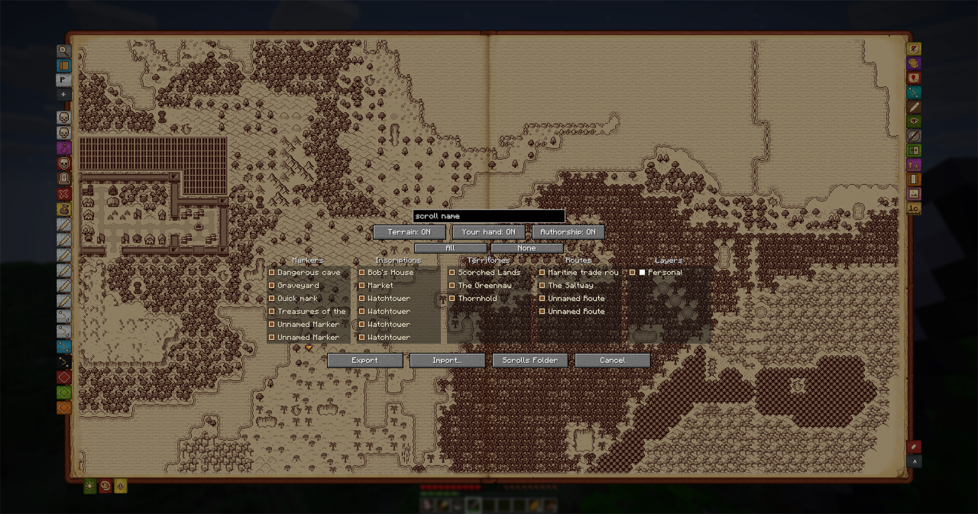 Choosing what goes on the scroll Pick exactly which marks, roads and territories travel, and whether the terrain goes with them.
Versions
Files
Relations
Project Relations
More like this
Similar Mods
Suggestions use data such as tags, dependencies, dependents, descriptions, titles, and more to rank how much they overlap with this mod.
On ModDex
Community snapshot
By the numbers
Statistics

Want to reach Minecraft players?
We're looking for a server hosting partner to feature here and other parts of the site. Interested? Send us a message!
Get in touchGet it on
Available Platforms
On ModDex
Community snapshot
By the numbers